- We will send in 10–14 business days.
- Author: Ptolemy Dean
- Publisher: Lund Humphries Publishers Ltd
- ISBN-10: 1848226837
- ISBN-13: 9781848226838
- Format: 26.4 x 28.2 x 3.2 cm, kieti viršeliai
- Language: English
- SAVE -10% with code: EXTRA
Reviews
Description
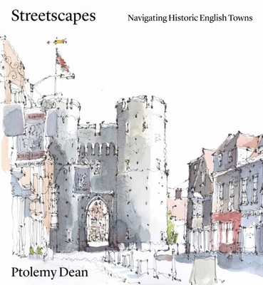
Featuring 26 of the most attractive and interesting historic town centres, this book analyses key routes and the urban or visual incidents along them and explains why they might provoke different sensations of joy, interest or containment for the inhabitant or passer-by. Each of the town studies includes two historical maps - one created by John Speed in the C16th, which explains the general overall layout of a town, its shape, size, defensive walls, and river crossings, and the other a first edition OS map from the late C19th, which reveals the extent that medieval arrangements have survived, or not. Key routes within selected towns are then selected and illustrated as a way to explaining the topography and layout of these towns and how one still experiences them. In particular, there is the recurring theme about how the town might naturally draw you through to its centre, the subtlety of character and placing of key buildings as markers, each of which is uniquely different for each town. The drawings which illustrated the town studies are not only beautiful, but can be discriminate in aspects emphasised.
EXTRA 10 % discount with code: EXTRA
The promotion ends in 21d.05:59:46
The discount code is valid when purchasing from 10 €. Discounts do not stack.
- Author: Ptolemy Dean
- Publisher: Lund Humphries Publishers Ltd
- ISBN-10: 1848226837
- ISBN-13: 9781848226838
- Format: 26.4 x 28.2 x 3.2 cm, kieti viršeliai
- Language: English English
Featuring 26 of the most attractive and interesting historic town centres, this book analyses key routes and the urban or visual incidents along them and explains why they might provoke different sensations of joy, interest or containment for the inhabitant or passer-by. Each of the town studies includes two historical maps - one created by John Speed in the C16th, which explains the general overall layout of a town, its shape, size, defensive walls, and river crossings, and the other a first edition OS map from the late C19th, which reveals the extent that medieval arrangements have survived, or not. Key routes within selected towns are then selected and illustrated as a way to explaining the topography and layout of these towns and how one still experiences them. In particular, there is the recurring theme about how the town might naturally draw you through to its centre, the subtlety of character and placing of key buildings as markers, each of which is uniquely different for each town. The drawings which illustrated the town studies are not only beautiful, but can be discriminate in aspects emphasised.


Reviews