- We will send in 10–14 business days.
- Author: Brian Mitchell
- Publisher: Genealogical Publishing Company
- ISBN-10: 0806312335
- ISBN-13: 9780806312330
- Format: 14 x 21.6 x 0.7 cm, softcover
- Language: English
- SAVE -10% with code: EXTRA
Reviews
Description
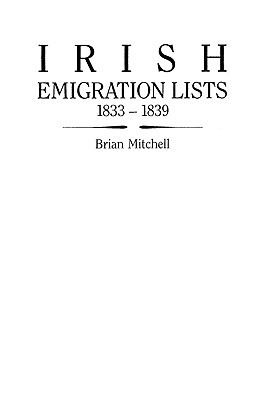
The purpose of the Ordnance Survey of Ireland was to map the whole country at a scale of six inches to one mile, and the six-inch maps appeared between 1835 and 1846. Each map was to have been accompanied by topographical descriptions, or memoirs, for every civil parish, but this was impractical, and the idea was abandoned. However, the field officers gathered much useful data, and the notebooks in which the information was recorded are now in the Royal Irish Academy in Dublin. They cover nineteen of Ireland's thirty-two counties, though the memoirs of Antrim and Londonderry are the only ones with lists of emigrants. These lists have been extracted, arranged under parish, and alphabetized, and they identify the emigrant's destination and his place of origin in Ireland--key pieces of information for anyone tracing his Irish ancestry. In addition, the age, town and address, year of emigration, and religious denomination are given for each emigrant. Over 3,000 emigrants are identified in this book.
EXTRA 10 % discount with code: EXTRA
The promotion ends in 20d.20:14:02
The discount code is valid when purchasing from 10 €. Discounts do not stack.
- Author: Brian Mitchell
- Publisher: Genealogical Publishing Company
- ISBN-10: 0806312335
- ISBN-13: 9780806312330
- Format: 14 x 21.6 x 0.7 cm, softcover
- Language: English English
The purpose of the Ordnance Survey of Ireland was to map the whole country at a scale of six inches to one mile, and the six-inch maps appeared between 1835 and 1846. Each map was to have been accompanied by topographical descriptions, or memoirs, for every civil parish, but this was impractical, and the idea was abandoned. However, the field officers gathered much useful data, and the notebooks in which the information was recorded are now in the Royal Irish Academy in Dublin. They cover nineteen of Ireland's thirty-two counties, though the memoirs of Antrim and Londonderry are the only ones with lists of emigrants. These lists have been extracted, arranged under parish, and alphabetized, and they identify the emigrant's destination and his place of origin in Ireland--key pieces of information for anyone tracing his Irish ancestry. In addition, the age, town and address, year of emigration, and religious denomination are given for each emigrant. Over 3,000 emigrants are identified in this book.


Reviews