- We will send in 10–14 business days.
- Publisher: Wiley-ISTE
- ISBN-10: 1789451574
- ISBN-13: 9781789451573
- Format: 15.6 x 23.4 x 1.8 cm, hardcover
- Language: English
- SAVE -10% with code: EXTRA
Ground Penetrating Radar (e-book) (used book) | bookbook.eu
Reviews
Description
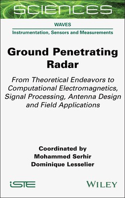
This book offers an overview of modern advances in Ground Penetrating Radar (GPR) for the reader hoping to understand comprehensive electromagnetic culture, combining instrumental development of radar, signal processing, imaging, and calibration/correction of measured data.
GPR has a multi-disciplinary character that can bring together a diverse and broad community. Of concern are the design and optimization of innovative radars, by virtue of the antennas and associated electronics, imaging algorithms, methodological diversity, calibration procedures, and the development of tools for the interpretation of data in mono-static or multi-static configurations within frequency or transient domains.
This book provides illustrations in civil engineering for the diagnosis of transport infrastructures and buildings, archeological surveys for the appreciation of cultural heritage, detection of underground pipes and cavities, estimation of soil water content for agriculture, and mapping of root trees developing underground, and in planetology, the analysis of the internal structure of planets and other celestial bodies through electromagnetic waves.
EXTRA 10 % discount with code: EXTRA
The promotion ends in 20d.14:10:53
The discount code is valid when purchasing from 10 €. Discounts do not stack.
- Publisher: Wiley-ISTE
- ISBN-10: 1789451574
- ISBN-13: 9781789451573
- Format: 15.6 x 23.4 x 1.8 cm, hardcover
- Language: English English
This book offers an overview of modern advances in Ground Penetrating Radar (GPR) for the reader hoping to understand comprehensive electromagnetic culture, combining instrumental development of radar, signal processing, imaging, and calibration/correction of measured data.
GPR has a multi-disciplinary character that can bring together a diverse and broad community. Of concern are the design and optimization of innovative radars, by virtue of the antennas and associated electronics, imaging algorithms, methodological diversity, calibration procedures, and the development of tools for the interpretation of data in mono-static or multi-static configurations within frequency or transient domains.
This book provides illustrations in civil engineering for the diagnosis of transport infrastructures and buildings, archeological surveys for the appreciation of cultural heritage, detection of underground pipes and cavities, estimation of soil water content for agriculture, and mapping of root trees developing underground, and in planetology, the analysis of the internal structure of planets and other celestial bodies through electromagnetic waves.


Reviews